UN
36 Queens Row
£ 245,000
Description
We don't have a Description for this property.
- Bedrooms
- 2
- Bathrooms
- 0
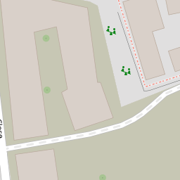

Leaflet © OpenStreetMap contributors
The heatmap indicates the level of crime in the area. The color of the heatmap indicates the crime severity and recency.
Metrics Year-on-Year
- Average area value
- 448,750.00 £Increased by 43.15 %
- Average area rental value
- 1,650.00 £/moIncreased by 60.98 %
- Est rental Yield
- 4.41 %Increased by 12.50 %
- Crime Rate
- 7.00 %Unchanged by 0.00 %
from 313,484.00 £
from 1,025.00 £/mo
from 3.92 %
from 7.00 %
Nearby Schools
| Name | Type | Ofsted | Distance |
|---|---|---|---|
| St Peter'S Church Of England Primary School | Voluntary Aided School | Good | 0.20 KM |
| Michael Faraday School | Community School | Good | 0.43 KM |
| Robert Browning Primary School | Community School | Good | 0.46 KM |
| South Bank University Academy | Academy Sponsor Led | Good | 0.52 KM |
| John Ruskin Primary School And Language Classes | Community School | Outstanding | 0.57 KM |
Images
Nearby Streets
| Name | Average Price | Average Sqft | Distance |
|---|---|---|---|
| Red Lion Close | £ 0 | 0 | 0.00 KM |
| Arnside Street | £ 0 | 0 | 0.00 KM |
| Boundary Lane | £ 495,931 | 0 | 0.00 KM |
| Silverthorne Lofts | £ 433,333 | 0 | 0.00 KM |
| Westmoreland Road | £ 353,333 | 0 | 0.00 KM |
Nearby Transport
| Name | NLC | TLC | Distance |
|---|---|---|---|
| Elephant And Castle | 5246 | EPH | 1.26 KM |
| Denmark Hill | 5421 | DMK | 1.86 KM |
| Loughborough Junction | 5082 | LGJ | 2.32 KM |
| London Bridge | 5148 | LBG | 2.36 KM |
| Waterloo East | 5158 | WAE | 2.83 KM |
Nearby Listings
| Address | Price | Type | Score | Distance |
|---|---|---|---|---|
| Queens Row, London, SE17 | £ 950,000 | BUY | 6 / 10 | 0.01 KM |
| Queens Row, London, SE17 | £ 525,000 | BUY | Unknown | 0.02 KM |
| Queens Row, London, SE17 | £ 400,000 | BUY | 4 / 10 | 0.02 KM |
| Queens Row, Camberwell, SE17 | £ 950,000 | BUY | Unknown | 0.02 KM |
| Queens Row, Elephant and Castle, London, SE17 | £ 950,000 | BUY | 6 / 10 | 0.03 KM |
Nearby Properties
| Address | Price | Distance |
|---|---|---|
| 36 Queens Row | £ 245,000 | 0.00 KM |
| 1c Horsley Street | £ 242,000 | 0.05 KM |
| 1e Horsley Street | £ 212,000 | 0.05 KM |
| 1b Horsley Street | £ 205,000 | 0.05 KM |
| 2 Horsley Street | £ 700,500 | 0.05 KM |